
Tiedosto:Prefecture map of Crete (Greece).svg

Tämän PNG-esikatselun koko koskien SVG-tiedostoa: 693 × 599 kuvapistettä. Muut resoluutiot: 278 × 240 kuvapistettä | 555 × 480 kuvapistettä | 888 × 768 kuvapistettä | 1 184 × 1 024 kuvapistettä | 2 369 × 2 048 kuvapistettä | 8 460 × 7 315 kuvapistettä.
Alkuperäinen tiedosto (SVG-tiedosto; oletustarkkuus 8 460 × 7 315 kuvapistettä; tiedostokoko 1,82 MiB)
.svg)
Yhteenveto
| Kuvaus |
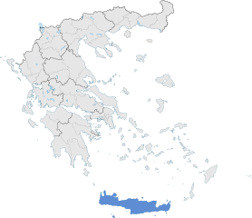
English: The prefecture of Crete within Greece. |
| Päiväys | |
| Lähde | Oma teos |
| Tekijä | SilentResident,Philly boy92 |
Lisenssi
Minä, tämän teoksen tekijänoikeuksien haltija, julkaisen täten tämän teoksen seuraavalla lisenssillä:
Tämä tiedosto on lisensoitu Creative Commons Nimeä-JaaSamoin 3.0 Ei sovitettu -lisenssillä.
- Voit:
- jakaa – kopioida, levittää ja esittää teosta
- remiksata – valmistaa muutettuja teoksia
- Seuraavilla ehdoilla:
- nimeäminen – Sinun on mainittava lähde asianmukaisesti, tarjottava linkki lisenssiin sekä merkittävä, mikäli olet tehnyt muutoksia. Voit tehdä yllä olevan millä tahansa kohtuullisella tavalla, mutta et siten, että annat ymmärtää lisenssinantajan suosittelevan sinua tai teoksen käyttöäsi.
- jaa samoin – Jos muutat tai perustat tähän työhön, voit jakaa tuloksena syntyvää työtä vain tällä tai tämän kaltaisella lisenssillä.
Tiedoston historia
Päiväystä napsauttamalla näet, millainen tiedosto oli kyseisellä hetkellä.
| Päiväys | Pienoiskuva | Koko | Käyttäjä | Kommentti | |
|---|---|---|---|---|---|
| nykyinen | 17. tammikuuta 2015 kello 18.00 | | 8 460 × 7 315 (1,82 MiB) | SilentResident | The Map has been updated to include some missing territories of Greece; fixed outline and color differences for some Greek islands in the Ionian and Aegean Seas that could confuse the readers. |
| 16. tammikuuta 2015 kello 22.34 |  | 7 304 × 7 315 (1,74 MiB) | SilentResident | {{Information |Description ={{en|1=The prefecture of Crete within Greece.}} |Source ={{own}} |Author =SilentResident,Philly boy92 |Date =2014-01-16 |Permission = |other_vers... |
Tiedoston käyttö
Seuraava sivu käyttää tätä tiedostoa:
Tiedoston järjestelmänlaajuinen käyttö
Seuraavat muut wikit käyttävät tätä tiedostoa:
- Käyttö kohteessa ar.wikipedia.org
- Käyttö kohteessa ast.wikipedia.org
- Käyttö kohteessa ca.wikipedia.org
- Käyttö kohteessa diq.wikipedia.org
- Käyttö kohteessa el.wikipedia.org
- Käyttö kohteessa en.wikipedia.org
- Käyttö kohteessa en.wikivoyage.org
- Käyttö kohteessa eu.wikipedia.org
- Käyttö kohteessa ga.wikipedia.org
- Käyttö kohteessa gl.wikipedia.org
- Käyttö kohteessa ha.wikipedia.org
- Käyttö kohteessa hy.wikipedia.org
- Käyttö kohteessa hyw.wikipedia.org
- Käyttö kohteessa ia.wikipedia.org
- Käyttö kohteessa la.wikipedia.org
- Käyttö kohteessa lb.wikipedia.org
- Käyttö kohteessa mzn.wikipedia.org
- Käyttö kohteessa tr.wikipedia.org
- Käyttö kohteessa tt.wikipedia.org
- Käyttö kohteessa www.wikidata.org
.svg)